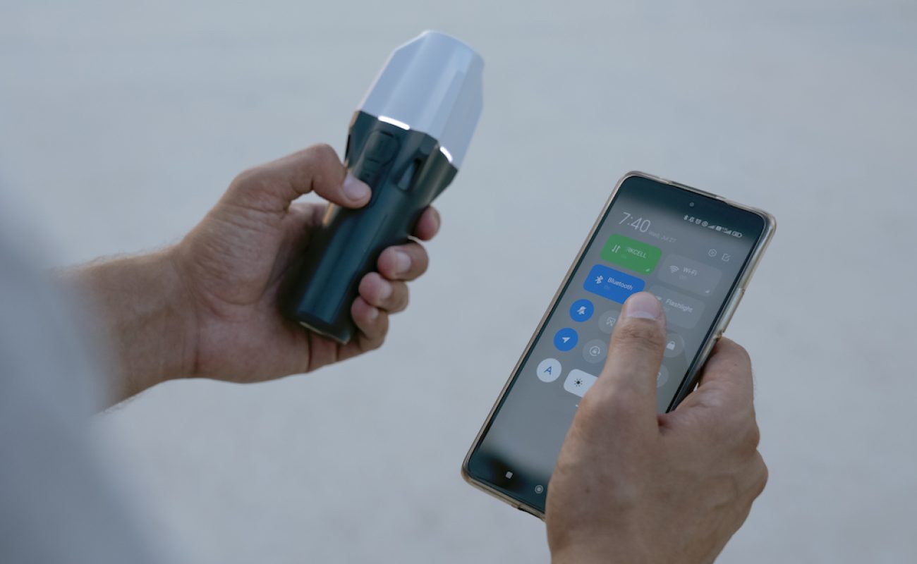
Emlid’s Reach RX is an easy-to-use GNSS receiver for location data collection in the field. Designed to meet the needs of both experienced professionals and non-surveyors who require highly accurate results, this groundbreaking device is one of the simplest devices for geographic data collection.
The Reach RX seamlessly connects to any iOS or Android device over Bluetooth, injecting real time high-precision data into all location-based apps on your phone and can be set up in minutes.
This article will go through the unique features of the Emlid Reach RX and how to set up your Emlid receiver with Skylark Nx RTK corrections, the most popular Skylark variant used with the Reach RX (you can learn more about the other variants here).
Features
When used with Skylark Nx RTK, the Reach RX delivers accuracy down to 2 cm without the need for a local base station. This opens up a broad set of high-precision GIS mapping use cases such as utility mapping or construction layout. The RTK update rate of 5 Hz ensures real-time data processing, which means you get more accurate readings in less time, enhancing overall efficiency. By operating across the L1, L2 and L5 bands, and leveraging multiple GNSS constellations, time accuracy and precision is improved. This also reduces the effects of signal obstruction from nearby buildings or vegetation.
Other standout features include its 16-hour battery life and operating temperature of -4 to 149 F, allowing for extended fieldwork in any weather condition on a single charge. Weighing in at just 250 grams, the Emlid Reach RX is lightweight and portable, making it easy to carry around in your pocket or glove compartment during long data collection sessions. The Reach RX offers a combination of accuracy, speed, and usability, making it an excellent choice for GIS professionals in need of reliable GNSS solutions.
For the full list of technical specifications, visit Emlid’s Reach RX product summary page.
Setting up the Emlid Reach RX with Skylark Nx RTK
Getting started with the Reach RX couldn’t be easier. Watch this video or read on to find out how.
First, long press on the button to boot it up. The green light indicates that it’s fully charged.
Next, you’ll need to connect it to your smartphone or tablet. On your mobile device’s app store, download the Emlid Flow app. Open the app and follow the on-screen instructions to grant access to “Local Network” and “Bluetooth”. Next, tap on your receiver in the Flow app to connect.
Once connected, you’ll need to configure the RTK corrections settings to begin ingesting corrections. This can be done by navigating to Correction Input or go to Profile > My NTRIP Profiles > Add Profile.
Give the NTRIP profile a name (“Skylark Nx RTK”, for example). Then go to Swift’s Skylark User Portal to fill in the rest of the required NTRIP information. Copy and paste the address, port, username, password, and finally the mount point, which, in the case of Skylark Nx RTK, is “NXRTK-MSM5”.
Save this configuration and apply it. Then, go to Receivers > Correction Input > NTRIP over Bluetooth. You’re now ingesting corrections!
Now, when you’re outside, in the app go to Survey. Here you can create new projects and just tap to save your geospatial data. It is that easy!
For optimal RTK performance when using network RTK, ensure you have a stable internet connection. Regularly update the firmware of your Emlid Reach RX to benefit from the latest improvements and bug fixes.
How are Network RTK corrections transformative for GIS?
There are two primary approaches to implementing RTK corrections for geographic data collection: Network RTK and RTK from a local base station.
Network RTK utilizes a web of multiple reference stations distributed over a wide area. This ensures consistent and reliable corrections across the coverage area, reducing the impact of localized errors. On the other hand, RTK from a local base station involves a single, locally placed reference station providing corrections to the rover (moving receiver). This provides highly accurate location data within a limited radius, however, these base stations are costly and the quality of corrections deteriorates with distance from the base station. A key advantage of Swift’s network RTK solution is its ability to cover a large geographic area at a lower cost, making it ideal for large-scale operations that require extensive coverage.
Find out more about the Emlid Reach RX.
Read about our partnership with Emlid.
