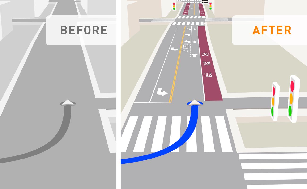
Inside GNSS recently published an article examining how precise GNSS enables scalable map augmentation for ADAS, autonomy, and fleet operations. Read it here.
What if building high-definition maps didn’t require expensive sensors, massive post-processing pipelines, or purpose-built fleets? What if any vehicle — even one already in service — could capture the world around it with centimeter-level precision?
There’s a more scalable way — and it starts with pairing a camera and precise GNSS.
Ground Truth at Global Scale
With a camera or dashcam, the vehicle captures features in its environment — road signs, lane markings, barriers, poles, and more. Precise GNSS provides the absolute positioning needed to anchor those features directly into a global reference frame, down to the centimeter.
This is what sets precise GNSS apart. Unlike purely relative SLAM-based systems that only estimate motion within a local context, precise GNSS enables absolute, globally consistent localization — which is critical when multiple vehicles, sensors, and systems must collaborate or contribute to a shared map.
Faster Updates, Lower Costs, Fewer Errors
Precise GNSS not only helps create maps — it makes it easier to maintain them. When features are globally anchored, detecting changes becomes straightforward:
- A stop sign missing its usual coordinates? Likely removed.
- A new pole in an unmapped location? Likely added.
- A feature detected in nearly the same spot as one from last week? Probably the same object.
This disambiguation is often impossible with low-precision positioning, where features jitter meters apart between passes. Without a global frame of reference, the system can’t easily determine whether an object is new or just slightly misaligned. The result: false positives, redundant annotations, and increased reliance on streaming data to the cloud for reconciliation.
By contrast, precise GNSS reduces ambiguity at the edge, enabling real-time decisions and on-device processing. The bandwidth and compute savings are substantial — making continuous map maintenance far more scalable.
Stable, Accurate Pose in All Conditions
Precise GNSS delivers a stable, drift-free global pose — even in complex conditions like urban canyons, dense foliage, or curved road segments. Heading and position remain in sync, ensuring that camera observations are aligned with global coordinates frame by frame.
Even small features like crosswalk signs or speed limit indicators can be placed with high fidelity. When accuracy is measured in centimeters, even minor changes to the environment become detectable — and mismatches become far less frequent.
From Mapping Fleets to Mapping Fleets-at-Scale
With this approach, any vehicle becomes a mapping asset — no need for specialized hardware or costly mapping fleets. Whether retrofitted or built-in, a GNSS receiver with RTK or PPP-RTK capability and a forward-facing camera is enough to contribute high-quality updates.
This dramatically reduces the cost and complexity of map coverage, making it possible to refresh HD maps continuously, at national or continental scale.
Powered by Skylark™
Swift Navigation’s Skylark Precise Positioning Service delivers real-time, centimeter-level GNSS accuracy across continents — purpose-built for high-integrity applications where safety and reliability are critical.
Skylark supports millions of devices simultaneously and is already trusted by 20+ global automotive OEMs and suppliers for advanced driver assistance, autonomy, and mapping.
If your maps rely on accuracy, consistency, and scalability — precise GNSS is the foundation, and Skylark makes it possible. Learn more at swiftnav.com.


