As GNSS correction technology advances, the transition from traditional RTK to atmospheric modeling marks a shift similar to the move from analog to digital—not only enhancing accuracy and reliability but also setting a new standard in precise positioning, transforming how we navigate and understand every centimeter of our planet.
Rather than relying on the conventional—and costly—method of adding more base stations, atmospheric modeling synthesizes observations from all stations in a region to create a dynamic map of the ionosphere and its disturbances. This approach extends coverage, preserves accuracy across larger areas, and provides smoother, more consistent corrections.
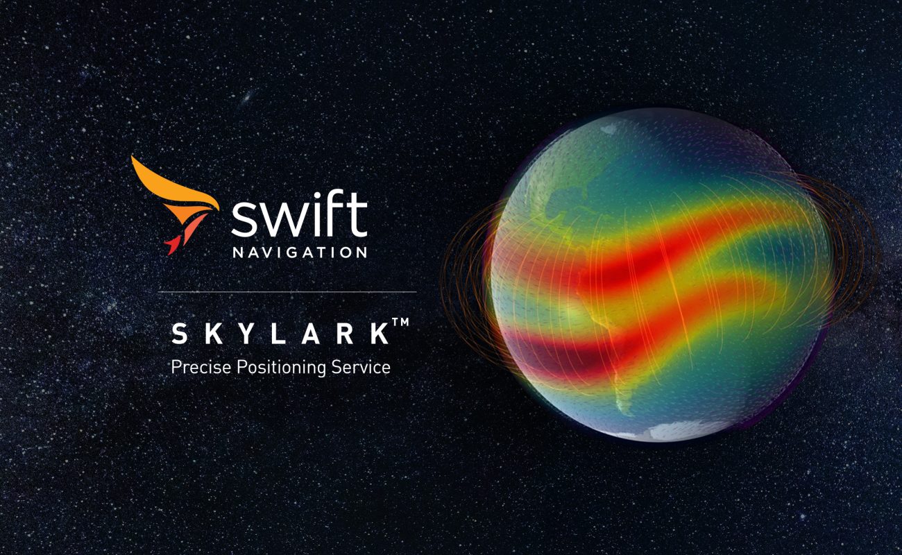
Swift Navigation has developed a cutting-edge, physics-based atmospheric model that, in tandem with a vast network of base stations, powers its Skylark Precise Positioning Service to deliver reliable, centimeter-level accuracy for applications ranging from autonomous vehicles to global logistics.
This article explores the benefits and applications of atmospheric modeling, showcasing how Swift’s innovative, future-proof approach is designed to meet the most challenging positioning needs of today and tomorrow.
From Local Base Stations to Wide-Area Coverage
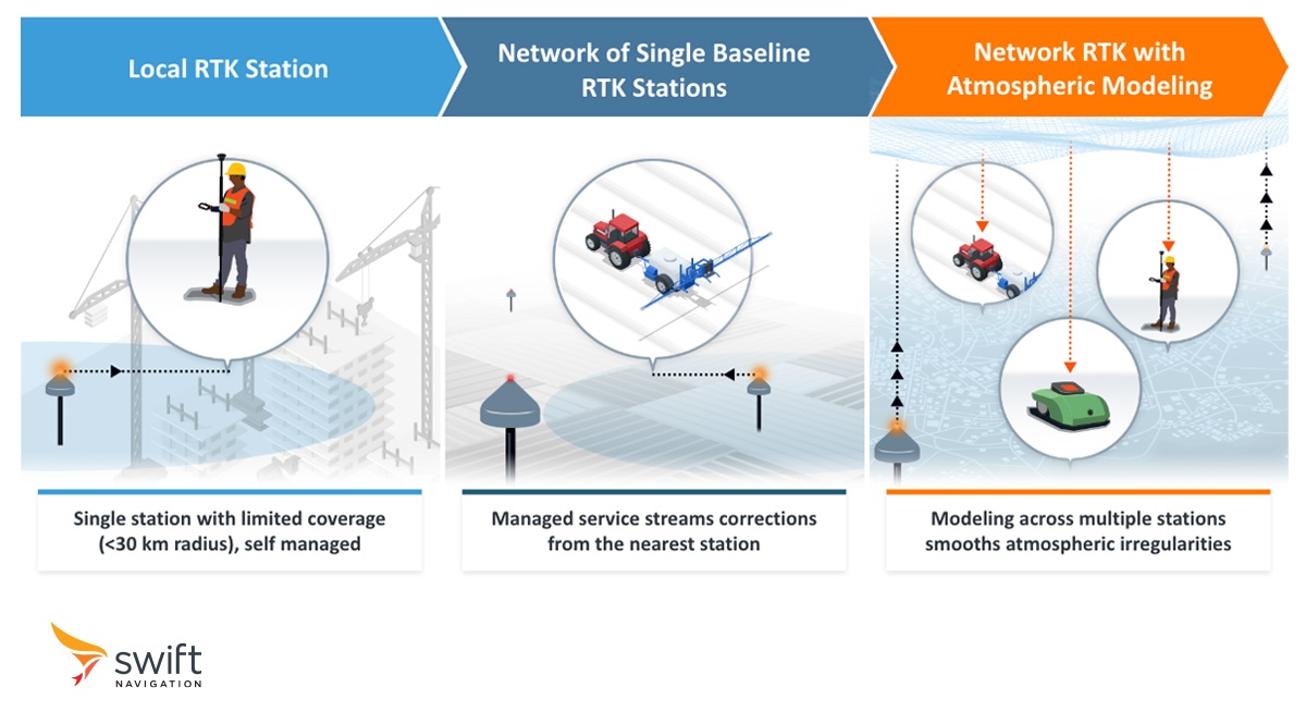
In the early days of GNSS corrections, the primary method for improving positioning accuracy involved using a single local RTK base station. This station would provide differential corrections to nearby users over VHF or UHF radio, effectively canceling errors caused by atmospheric effects as well as satellite orbit and clock inaccuracies. However, the coverage area was limited to a few kilometers around the base station.
As demand for high accuracy grew across wider areas, networks of multiple base stations have emerged. These RTK networks provide a convenient way for users to connect to a nearby station, allowing more flexible access to corrections. However, each base station is still treated as an independent entity, broadcasting its own localized corrections without making use of data from neighboring stations. While this approach provides easier access to corrections, it lacks the ability to integrate data into a unified model, resulting in discontinuities between coverage areas and limiting accuracy over larger regions.
Today’s applications require seamless positioning across broad geographic areas and have given rise to solutions with continuous coverage. These solutions use a combination of ground networks and atmospheric modeling to deliver precise corrections to users anywhere within the coverage zone, paving the way for applications like autonomous vehicles and global logistics.
The Path to Atmospheric Modeling
In an RTK system, the distance between the base station and receiver, or rover, significantly impacts accuracy due to the localized nature of ionospheric and tropospheric conditions. A base station’s observations are reliable within a radius of about 25 km; beyond that, the relevance of corrections diminishes, and applying them can sometimes increase errors rather than reduce them. This technique is also highly dependent on station quality, as any errors in its observations directly impact the accuracy achievable at the receiver.
One method to enhance RTK accuracy is through spatial diversity, achieved by increasing the density of reference stations to ensure rovers are always close to one. However, this brute-force approach can be prohibitively costly and challenging to scale, with expenses often passed on to customers. Ensuring consistent quality when performance is dependent on individual stations presents availability limitations too.
Another approach is to create an atmospheric model that accounts for how GNSS signals are affected by varying atmospheric conditions. A basic implementation of this is to interpolate observations between stations, generating a geometry-based model. However, ionospheric variations are highly dynamic and can fluctuate significantly over short distances—changes that a static geometric model cannot capture. As a result, this technique may extend coverage slightly beyond a station’s traditional baseline, but typically no more than a few kilometers.
Swift’s Atmospheric Model
Swift’s team of physicists and engineers has developed a physics-based atmospheric model that considers the composition and physical properties of the atmosphere’s different layers. Atmospheric gases, such as oxygen and nitrogen, ionize and de-ionize at varying rates under solar radiation and at different altitudes. This process causes fluctuations in the atmosphere’s electron content throughout the day, resulting in variable delays that impact GNSS signals. By modeling these complex interactions across space and time, this robust atmospheric model can accurately estimate local ionospheric and tropospheric conditions across its coverage area and throughout the day.
Source: NOAA Space Weather Prediction Center
This advanced physics-based atmospheric model powers Swift’s Skylark Precise Positioning Service. Available in three tailored variants, Skylark leverages this model to meet the unique demands of diverse applications, with each variant enhancing positioning accuracy, coverage, and reliability in both similar and specialized ways.
Achieving accurate atmospheric modeling is exceptionally challenging, requiring continuous training and refinement to keep pace with dynamic ionospheric conditions. Swift’s model is fueled by an extensive, ever-growing dataset from its vast network of base stations, with real-time data fed back into a machine learning framework within Swift’s AWS-powered cloud infrastructure. The model runs on a spatially distributed, redundant AWS environment, using independent service channels and diversified Amazon EC2 compute to ensure resilient, high performance processing without interruptions.
This framework operates in a continuous feedback loop, allowing the model to adapt swiftly to shifting atmospheric patterns, satellite inconsistencies, and varied ground conditions across large areas. As a result, Skylark consistently delivers exceptional accuracy and resilience, positioning Swift far ahead in the field and at the forefront of GNSS innovation as the model evolves.
What Are The Key Benefits of Atmospheric Modeling?
The difference between traditional and atmospheric model-powered RTK is like the leap from analog to digital: atmospheric modeling digitally captures and augments analog observations, unlocking multiple new benefits.
Extended Centimeter-Level Accuracy: In the Skylark Nx RTK variant, this model allows receivers to maintain RTK’s centimeter-level accuracy more than 70 km from the base station, extending traditional RTK’s range threefold and eliminating the need for a denser network of stations—an alternative that would require over nine times as many base stations.
Achieving Continent-Wide Coverage: Swift’s atmospheric model enables continent-wide coverage in its Skylark Cx and Dx variants. Based on PPP-RTK and DGNSS technologies, respectively, these two variants provide decimeter accuracy while ensuring continuous, consistent performance across continents.
Seamless Transition Across Coverage Zones: Another key advantage of atmospheric modeling over adding more base stations is its ability to eliminate discontinuities between base station areas. In a dense traditional RTK network, even when a rover is handed over from one base station to another, it often experiences a noticeable “jump” or step change in accuracy, resulting in erratic position shifts during the handoff. Atmospheric modeling enables seamless, continuous accuracy across regions, enabling smoother transitions and higher reliability for rovers moving between coverage areas.
Improved Integrity Monitoring for Greater Reliability: Swift’s atmospheric modeling also enables integrity monitoring. By analyzing ionospheric data across broad regions and over time, the model continuously assesses and predicts variations in signal delay. This allows for real-time monitoring of potential anomalies and disruptions, providing rovers with alerts on signal reliability and expected positioning accuracy. Skylark’s commitment to safety is underscored by its recent certification as the first cloud-based real-time service to comply with ISO 26262, a globally recognized automotive functional safety standard.
No Single Point of Failure: Unlike traditional RTK systems, where the loss of a base station can interrupt corrections and compromise accuracy, atmospheric modeling provides a much more robust solution with no single point of failure. If a station is deemed unhealthy or experiences failure, the model automatically adapts, filling in the gap using data from surrounding stations to maintain consistent accuracy. In RTK mode, the receiver seamlessly switches to the next closest station, ensuring uninterrupted service and reliability in challenging environments.
Applications Enhanced by Atmospheric Modeling
Network RTK eliminated the burden and cost of building and operating a local base station, which can be a significant investment. However, this benefit is only valuable if the network can deliver consistent, high accuracy. Atmospheric modeling ensures that Network RTK delivers the precision needed – everywhere and always – allowing users to confidently rely on positioning without disruptions or costly infrastructure.
Here are some applications that benefit from atmospheric modeling in GNSS corrections:

Autonomous Vehicles: Reliable accuracy is critical for autonomous vehicles, especially in complex environments like urban centers and highways. The robustness of Swift’s atmospheric modeling enables adherence to stringent integrity requirements for the automotive industry, supporting compliance with standards like ISO 26262, essential for functional safety in autonomous driving applications. Learn more.

Outdoor Robots: Robotic lawnmowers and other outdoor robots depend on centimeter-level accuracy to maintain consistent paths and avoid obstacles, especially over large properties and varied terrain. With atmospheric modeling, these devices receive stable GNSS corrections across expansive areas, reducing the need for multiple base stations and enhancing operational efficiency. Learn more.

Surveying and Construction: Atmospheric modeling eliminates position jumps and improves accuracy across diverse site conditions. Wide-area corrections mean that surveyors and machines can work with precise GNSS data over large project sites, improving workflow efficiency and data reliability without the limits imposed by local base station ranges. Learn more.

Global Logistics: Tracking assets across long distances with continuous, accurate GNSS positioning is essential in logistics. Atmospheric modeling provides precise, continent-wide corrections, enabling logistics companies to monitor goods and vehicles as they move across regions with varied ionospheric conditions. This consistency enhances supply chain visibility and operational effectiveness. Learn more.

Mobile Apps: Apps for navigation, ridesharing, and fitness benefit from precision corrections to deliver highly accurate, real-time location data for turn-by-turn directions, exact pickup points, and reliable activity tracking. With continent-wide coverage and robust accuracy, these apps provide smoother, uninterrupted user experiences, even where traditional GNSS signals struggle. Learn more.

Drones: Drones, especially in applications requiring beyond-visual-line-of-sight (BVLOS) operations, depend on highly accurate GNSS corrections for navigation and safety. With wide-area atmospheric modeling, drones maintain precise positioning over large regions, supporting safe, reliable flight paths and effective airspace management. Learn more.
These applications highlight the power of atmospheric modeling to provide reliable, accurate GNSS positioning across vast and diverse environments, eliminating the need for localized infrastructure while expanding the scope and impact of GNSS-dependent technologies.
To learn more about how Swift’s Skylark Precise Positioning Service can enhance GNSS accuracy for your application, visit our website’s Skylark section, browse its Solutions sections, or contact us to discuss your needs and get started. Whether for autonomous vehicles, drones, robotic equipment, or logistics solutions, Skylark’s advanced atmospheric modeling and wide-area corrections offer the reliable, precise positioning your application needs.
