Precision in positioning systems refers to the consistency or repeatability of position measurements under unchanged conditions. In other words, precision describes how closely repeated measurements or estimated positions cluster together, regardless of how close they are to the true position. In GNSS (Global Navigation Satellite System) applications, precision is typically quantified by the standard deviation or spread of a set of position solutions, often expressed as a radius or distance within which a certain percentage (e.g., 68% or 95%) of measurements fall.
High precision is essential for applications that require reliable and repeatable positioning, such as autonomous vehicles, advanced driver assistance systems (ADAS), robotics, surveying, and fleet management. For example, in autonomous driving, high precision ensures that a vehicle can follow the same path or lane repeatedly, even if the absolute position is offset from the true value. This repeatability is critical for tasks like lane-keeping, automated parking, and geofencing, where consistent performance over time is required for safety and operational efficiency.
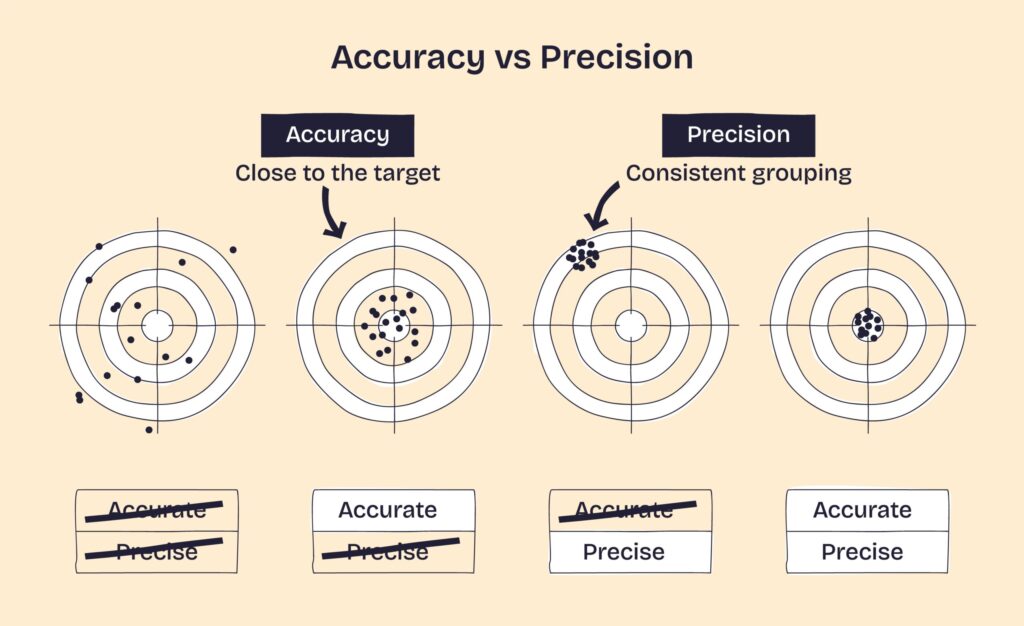
Precision is distinct from accuracy: while accuracy measures how close a reported position is to the true position, precision measures how close repeated measurements are to each other. A system can be highly precise but not accurate if its measurements are tightly grouped but consistently offset from the true value. Conversely, a system can be accurate on average but imprecise if its measurements are widely scattered.