




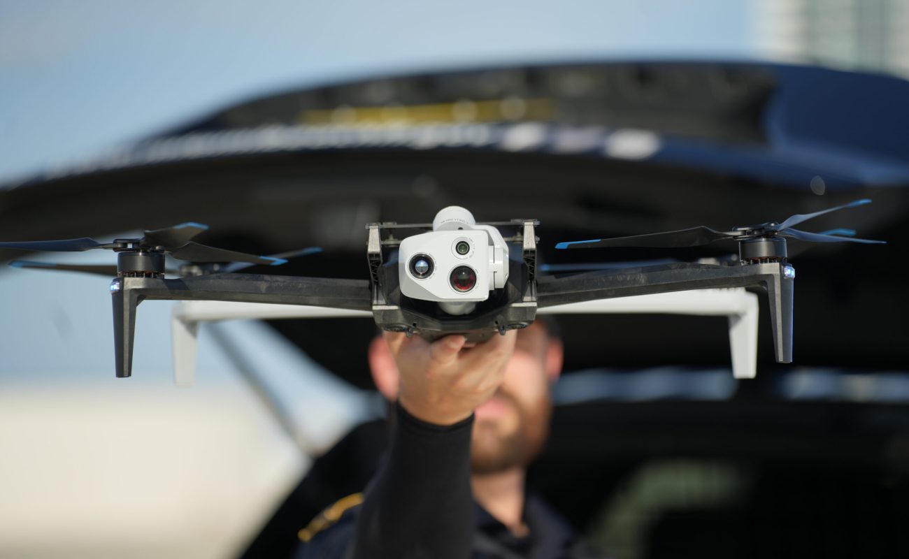
Inaccurate spatial data can derail aerial mapping projects, leading to misaligned photogrammetry models, inaccurate volumes in site calculations, and costly re-flights. With the Skydio X10, commercial operators have access to an enterprise-grade drone platform. By combining the X10’s RTK/PPK attachment with Skylark Nx RTK—Swift Navigation’s cloud-based network RTK service—you can capture survey-grade, centimeter-accurate data directly in real-time, right out of the box.
By integrating Skylark’s cloud-delivered network RTK corrections, operators unlock 1–2 cm absolute positioning without the hassle or expense of purchasing, transporting, setting up, and managing a physical local base station on-site.
This article walks through setting up Skylark subscriptions in the Skylark User Portal, configuring your Skydio X10 controller, and exploring how Network RTK transforms commercial drone operations.
Why Skylark Nx RTK for the Skydio X10?
The Skydio X10 RTK/PPK attachment hardware is compatible with Skylark Nx RTK, a high-precision variant designed for RTK-capable receivers equipped with an NTRIP client. Unlike standard approaches that rely on simple geometric interpolation or single local base stations—where correction quality degrades as the drone flies further away—Skylark leverages a sophisticated physical model of the atmosphere. By estimating atmospheric conditions along every individual signal path rather than relying on proximity-based estimates, Skylark delivers consistent accuracy, fast convergence times, and broad coverage across North America, Europe and Asia.
This advanced atmospheric modeling provides distinct operational advantages, including superior storm resilience by correcting ~95% of ionospheric delay, the elimination of position jumps or boundary discontinuities common in other network providers, and enhanced signal integrity by proactively excluding corrupted data. You can verify your local coverage on our RTK coverage map.
Promotional Offer
Ready to experience survey-grade aerial accuracy? Take advantage of our joint promotion with Skydio and claim a One Month Skylark Free Trial for your Skydio X10.
Claim Free Trial →Step 1: Generate Credentials in the Skylark Portal
Before powering up your controller, sign up for Skylark in the User Portal and retrieve your NTRIP credentials. Be sure to take advantage of our 1 month free trial promotion.
- Log in or Sign Up: Head to the Skylark User Portal and create or log in to your account.
- Retrieve Regional Host Endpoint: Select the region matching your operational area: North America, Europe, or Asia Pacific.
- Copy Port & Credentials: Note down Port 2101, as well as your dedicated NTRIP Username and Password.
- Identify Mount Point: For the Skydio X10, choose the mount point that aligns with your project requirements.
For set-up and configuration advice, refer to our Skylark Portal User Guide.
Step 2: Configuring the Skydio X10 Controller
With your Skylark credentials ready, the final step is to configure your Skydio X10 controller to receive the correction stream. For a seamless setup experience, please refer to our Skydio X10 configuration and support guide. This resource provides the most accurate and up-to-date visual walkthroughs and step-by-step instructions to get you ready for flight.
How Real-Time Network RTK Transforms Drone Mapping
Integrating real-time Network RTK into drone operations fundamentally changes how mapping and inspection teams work in the field.
| Workflow Step | Traditional GCP / PPK Approach | Skylark Network RTK Approach |
|---|---|---|
| Field Prep | Setting & measuring ground control points (GCPs) with base stations (1–2+ hours) | Unpack drone, connect controller to internet, fly immediately |
| Hardware Overhead | Heavy base stations, tripods, extra batteries, and survey poles | Lightweight RTK attachment on drone; no ground hardware |
| Processing | Post-processing kinematic (PPK) log syncing & manual software alignment | Real-time 1–2 cm positioning baked directly into image geotags |
| Field Time | High labor hours per site | Rapid deployment and faster turnaround times |
Primary Use Cases of RTK-Enabled Drones
- Construction & Site Surveying: Rapid volumetric measurements, cut/fill analysis, and progress tracking without walking active construction sites to place target tiles.
- Utilities & Infrastructure Inspection: Precise asset logging for power lines, solar farms, and pipelines where consistent georeferencing is essential for thermal or visual inspection overlays.
- Photogrammetry & LiDAR Mapping: High-density point cloud generation with absolute accuracy, removing post-processing bottlenecks so deliverables can be generated immediately upon landing.
Get Started Today: Discover how effortless precise positioning can be. Learn more about our drones solution or start your Skydio X10 One Month Free Skylark Trial today. Learn more about Skydio’s solution for surveying and mapping.