







Centimeter-Accurate Positioning to Power Physical AI at Scale
To act safely, a physical AI system needs three things: perception (what is around me?), reasoning (what should I do?) and localization (where exactly am I?). Cameras, LiDAR and AI models handle the first two, but they can’t tell a machine exactly where it is in the world. Skylark Precise Positioning Service handles the third, delivering centimeter-accurate, high-integrity absolute positioning on a shared global frame, across continents. Every machine in a fleet works from the same view of the world, with no base stations to install.
Absolute Accuracy
Solves for edge cases where perception sensors can’t reliably place the vehicle
Built to Scale
Solves for edge cases where perception sensors can’t reliably place the vehicle
Certified Safe
Delivers high-integrity positioning for safety relevant use cases
Edge-Friendly
Geotags road features at scale for faster identification and edge processing
ABSOLUTE ACCURACY
The Missing Layer in Physical AI

CHALLENGE
Most physical AI systems estimate position relative to what they can sense. Odometry and visual localization drift over distance, every system ends up with its own private version of the world, and runways, fields, open roads and construction sites offer few features for cameras or LiDAR to lock on to.
SWIFT SOLUTION
Skylark is a cloud-based correction service that improves GNSS accuracy from several meters to a few centimeters. Skylark is powered by a proprietary atmospheric model that combines machine learning with physics-based constraints. It stays consistent through challenging ionospheric conditions, smooths performance as machines move between stations, and draws on Swift’s entire network to stay reliable even during station outages.
CERTIFIED SAFETY
A Position You Can Trust
CHALLENGE
A machine near people has to know not just its position but how far it can trust it. Standard GNSS gives several meters of error — fine for general navigation, not for a car that must operate autonomously in ever-changing environments.
SWIFT SOLUTION
Skylark is the first real-time, cloud-based positioning service certified to ISO 26262 for automotive functional safety, with optional integrity bounds that tell the system how accurate its position is and when it can no longer be relied on.

BUILT TO SCALE
One Shared Frame for Every Machine
CHALLENGE
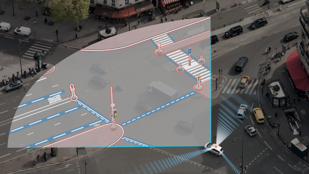
Without a shared reference frame, combining passes from many machines needs heavy cloud reconstruction. Local RTK base stations have previously been the answer, but they are costly, hard to deploy and don’t scale across a fleet operating in many cities or countries.
SWIFT SOLUTION
No base stations to install. Cloud-delivered corrections across North America, Europe and Asia-Pacific, with 99.9% availability. Every machine shares one absolute frame, and the Starling Positioning Engine fuses sensors to keep position continuous when satellite signals drop.
Where Swift Powers Physical AI Today
One positioning layer across every kind of machine.

Driverless cars and freight need lane-level, high-integrity positioning that complements cameras and radar, natively integrated with NVIDIA DRIVE AGX.

Delivery, airfield, agricultural and lawn-care robotsneed to follow a path to the doorstep and stay inside their geofence across whole cities, without local infrastructure.

Fleets of everyday vehicles become mapping sensors, keeping a live digital twin of roads, curbs and assets on one shared, accurate frame.

Inspection, mapping and delivery drones need precise, reliable position to fly beyond line of sight and capture georeferenced data.

Autonomous earthmovers, haul trucks and site robots need to work to design plans and keep a safe distance from people and equipment.

Autonomous tractors, sprayers and weeders work open fields with few landmarks for cameras, so they need centimeter accuracy to hold their rows.
Natively Integrated With NVIDIA DRIVE AGX
The Starling SAL plugin for NVIDIA DriveWorks gives OEMs a drop-in path to globally referenced, centimeter-accurate positioning through the Swift Automotive Suite.
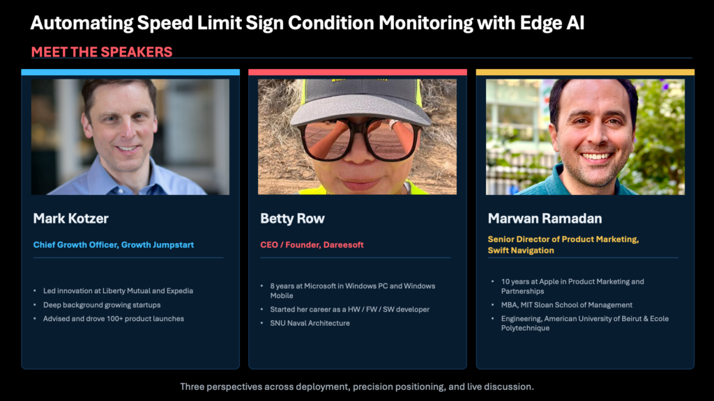
From Detection to Decision: How Edge AI + Precise Positioning Work Together
We partnered with DareeSoft, a road information mapping provider, to demonstrate how a major US city monitors speed limit signs at scale with edge AI and precise GPS.
The combined solution of Dareesoft’s dash-mounted AI camera and Skylark identified 2,496 road signs, including 90 damaged and 20 missing, with duplicates filtered at the edge.
The Physical AI Stack
Physical AI is built in layers, from the hardware that moves to the services people pay for, and each layer depends on the ones beneath it. Swift provides one of them: the precise positioning that tells every layer above exactly where the machine is.
-
10
Applications and Services
Robotaxi rides, parcel deliveries, inspections, crop treatment: the outcome the customer actually pays for.
-
9
Fleet Operations and Cloud
Dispatch, remote monitoring, over-the-air updates, and the data pipelines that train and validate AI models.
-
8
Control
Turns the plan into steering, braking, throttle and motor commands, many times a second.
-
7
Prediction and Planning
AI models forecast what nearby people and vehicles will do, then choose a safe path and behavior.
-
6
Maps and World Model
HD maps, geofences and digital twins that give the machine context beyond what its sensors can see. Precise positioning anchors every map update to the right place.
-
5
Positioning and Localization
Where exactly I am: GNSS corrections fused with IMU and odometry for an absolute, high-integrity position on one global frame. This is the layer Swift delivers, through Skylark and the Starling Positioning Engine.
5Perception
What is around me: detects the objects, lanes, signs and people around the machine from camera, LiDAR and radar data.
-
4
Edge Compute and Middleware
Onboard AI processors and real-time software that run every layer above, on the machine itself. Swift's positioning engine integrates natively with platforms such as NVIDIA DRIVE AGX.
-
3
Connectivity
Cellular and V2X links that carry map updates, fleet data and GNSS corrections, including Skylark's, between machine and cloud.
-
2
Sensors
Cameras, LiDAR, radar, GNSS receivers and antennas, IMUs and wheel encoders. Skylark works with mass-market GNSS chipsets, not just survey-grade receivers.
-
1
Vehicle Platform and Actuation
The chassis, motors, batteries and drive-by-wire systems that physically move the machine.
-
Across Every Layer: Functional Safety and Security
Safety cases, redundancy, integrity monitoring and cybersecurity that bound how far each layer can be trusted. Skylark is certified to ISO 26262 for automotive functional safety.
Inside Swift's Positioning Layer
Pick the service that matches the machine.
| Need | Swift Product | Accuracy |
|---|---|---|
| Robots, drones, mapping | Skylark Nx RTK (network RTK) | 1–2 cm |
| Vehicles and fleets, continent-wide | Skylark Cx (PPP-RTK) | 3–7 cm |
| Low-power devices, micromobility | Skylark Dx (DGNSS) | Sub-meter |
| Safety-critical vehicle localization | Swift Automotive Suite: Skylark + Starling Positioning Engine, optional ASIL | Lane-level, high integrity |
Give Your Machines a Place in the World
Test Skylark on your own hardware with a free trial, or talk to our team about positioning for your physical AI platform.
Frequently Asked Questions
What is physical AI?
Physical AI is artificial intelligence that perceives, reasons and acts in the real world through machines such as robots, autonomous vehicles and drones. Unlike AI that works only with text or images, it has to make decisions that move mass through space, often near people.
Why does physical AI need precise positioning?
Every decision a physical AI system makes, from path planning to map updates, depends on knowing exactly where it is. Centimeter-level absolute positioning gives machines a shared reference frame that cameras and LiDAR alone can't provide.
What is the best GNSS correction service for physical AI?
The right service combines centimeter accuracy, wide coverage, high availability and a safety case. Skylark provides 1–2 cm network RTK, continent-wide PPP-RTK, 99.9% availability and ISO 26262 certification, without local base stations.
How is GNSS different from visual or LiDAR localization?
Visual and LiDAR localization estimate position relative to what the machine can see, so they drift and struggle in featureless areas. Precise GNSS gives an absolute position on a global frame; most physical AI systems use both, fused together.
Do I need RTK base stations for my robots?
No. Skylark delivers RTK corrections from the cloud over the internet, so robots get centimeter accuracy across a region without installing or maintaining local base stations.
Does Skylark work with my GNSS hardware?
Skylark Nx RTK works with any standards-compliant RTK receiver over NTRIP and RTCM, and Swift partners with chipset and module makers including u-blox, Quectel, STMicroelectronics and Telit Cinterion.
Can precise positioning help train physical AI models?
Yes. Fleets that anchor every detection to centimeter-accurate coordinates produce georeferenced, deduplicated ground-truth data, which autonomous vehicle and robotics developers use to train and validate models.