


Executive Summary
To manage aging infrastructure, municipalities and fleet operators have traditionally relied on manual inspections and expensive, specialized survey vehicles. These methods are slow, prone to human error, and often lack the lane-level precision needed to distinguish specific assets in dense urban environments.
Raven Connected provides an end-to-end AI video telematics and intelligent transportation systems (ITS) platform to transform road data into predictive insights.
By integrating Swift Navigation’s Skylark™ Precise Positioning Service with Raven Connected’s AI video telematics platform, everyday service vehicles are transformed into high-precision mapping sensors. This collaboration closes the “data gap,” allowing for the automated detection and geocoding of road assets with centimeter-level accuracy.
The Challenge: The Costly “Data Gap” in Infrastructure
Standard GPS—which is typically accurate to only 3–5 meters—cannot reliably distinguish between adjacent lanes or pinpoint the exact location of a pothole, damaged sign, or worn lane marking. For public works teams, this lack of precision leads to:
- Reactive Maintenance: Repairs are often addressed only after they become major hazards.
- Budget Inefficiency: Significant resources are wasted on manual verification and the deployment of dedicated survey crews.
- Safety Risks: Unseen or mislocated defects increase liability and public safety concerns.
The Solution: Crowdsourced Precision at the Edge
Raven Connected provides an end-to-end AI video telematics platform that uses edge computing to analyze road video in real time. By embedding Swift’s corrections into Raven’s Onboard Units (OBUs), the partnership delivers “Ground Source Truth” directly from existing fleets (such as utility vans or delivery trucks).
- Skylark Precise Positioning Service: Delivers centimeter-level accuracy and high integrity, even in urban canyons where satellite signals are often blocked or reflected.
- Edge-Computing AI: Raven’s computer vision models detect road features—signage, lane markings, and defects—while the vehicle is in motion.
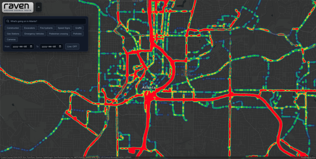
- Real-Time Digital Twins: The fused data creates a living, self-healing map of the road network, geocoding every detection with lane-level certainty.
The Results: Smarter, Scalable Road Management
The integrated solution allows municipalities and fleet operators to move from reactive to proactive infrastructure management:
- Automated Asset Mapping: Eliminates the need for dedicated survey vehicles by crowdsourcing data during regular operations.
- Lane-Level Precision: Provides the accuracy required to distinguish hazards in specific lanes, streamlining work-order generation for repair crews.
- Future-Ready HD Maps: The continuous stream of high-fidelity, anonymized data provides a scalable “Living Map” layer essential for the validation and safe operation of autonomous vehicles (AVs).
"By embedding Swift’s precise GNSS technology, we ensure our partners aren’t just getting data, they are getting ‘Ground Source Truth.’ This level of precision is the cornerstone of responsive infrastructure management."
— Dan Carruthers, CEO, Raven Connected