


")
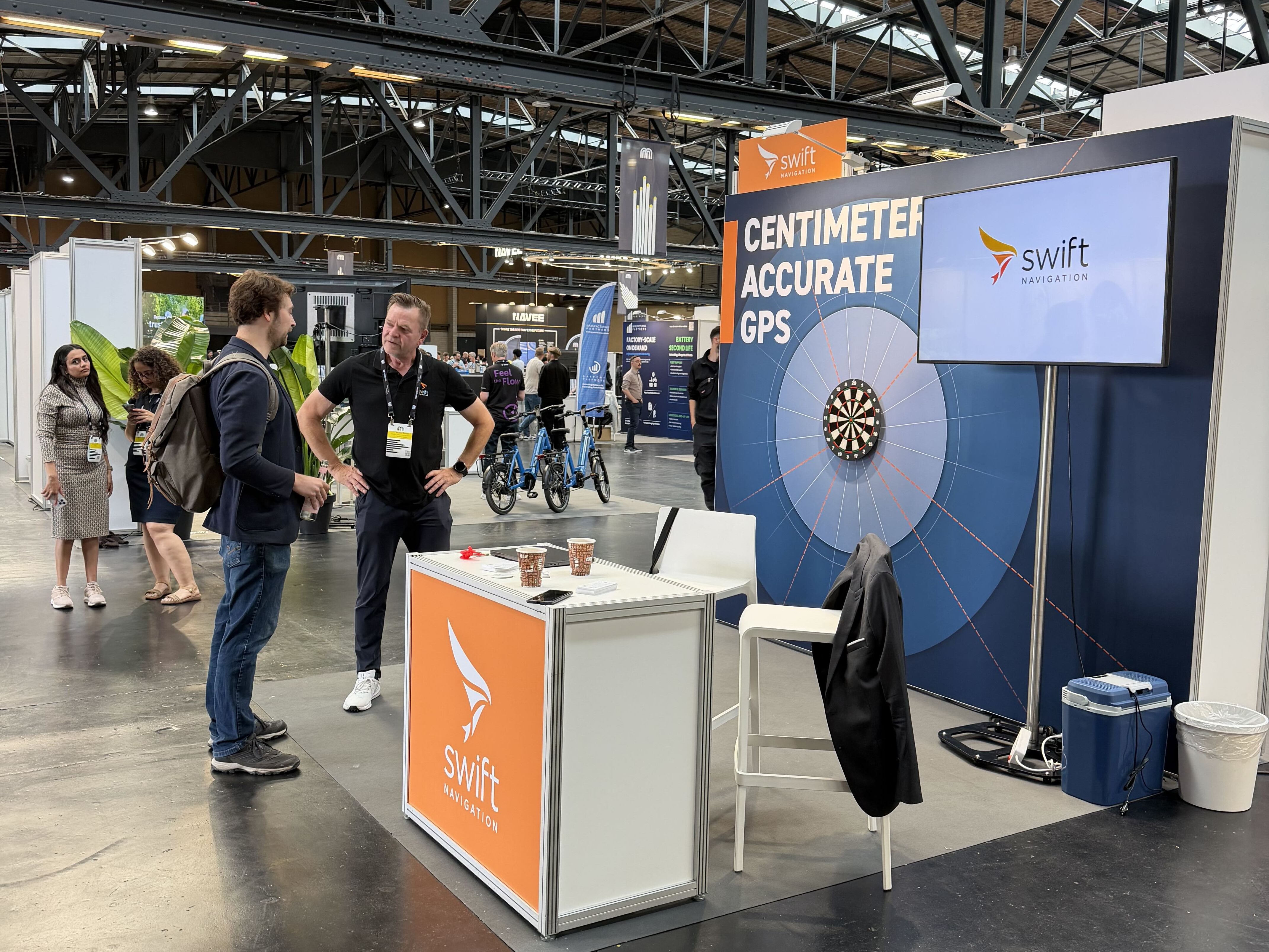
Swift Navigation recently attended Micromobility Europe 2026, where we had the opportunity to meet and engage with leading operators and city planners shaping the future of urban micromobility. There was a lot of great substance — and a clear sense that the industry is at an inflection point. To get the full rundown, we sat down with Jochen Bruns, Regional Director for Europe at Swift Navigation.
Micromobility has seen explosive growth over the last decade, transforming how people move through cities. The market is expected to reach $340 billion by 2030, according to a McKinsey report. But as fleets scale, so does pressure from city authorities. The early adopter phase is over — this is now a mature market where sustainable, profitable growth and collaboration with cities determine who survives. Fleet operators are increasingly turning to high-precision GNSS correction services to meet challenges in safety, compliance, cost efficiency, and customer experience.
Jochen Bruns is a seasoned expert in IoT applications with over two decades of commercial experience. Building on a foundation in technical computer science, Jochen has been instrumental in developing cutting-edge IoT solutions that meet real-world business needs. He shares insights into how Skylark™ cloud-based GNSS corrections are helping micromobility operators deploy smarter, more reliable, and more scalable fleets.
EP: As the micromobility market continues to grow, how are evolving urban regulations and compliance requirements creating demand for precise positioning in micromobility?
JB: As micromobility popularity grows, so does scrutiny from city regulators. Operators are now under pressure to meet a new wave of location-based rules, from ensuring scooters park within tight geofenced zones to automatically reducing speed in pedestrian-heavy areas. In many cities, scooters are also required to stick to bike lanes and avoid car traffic altogether. These aren’t just guidelines, they’re mandatory. But enforcing them with standard GNSS, which can have errors of several meters, simply isn’t realistic. Without higher-precision positioning, it’s nearly impossible to guarantee compliance, decrease the safety risks associated with shared vehicles, and improve user experience.
This is already playing out across Europe. Brussels, for example, has announced a ban on e-scooters from 2027 — a direct consequence of persistent compliance and safety failures. Paris has moved in a similar direction. These aren’t edge cases; they’re a signal of what happens when operators can’t demonstrate control to city partners.
EP: You've described Swift as more than just a technology vendor in this space. What does that mean in practice?
JB: We’re a horizontal technology provider — we don’t build the end-user application. But that also means we’ve had to invest real effort into understanding the specific operational challenges micromobility operators face. What we consistently hear is that this is appreciated. Operators want to work with partners who understand their environment, speak their language, and have thought through the nuances of urban fleet operations. We consider micromobility to be one of the core areas where urban transportation will evolve significantly — and we want to be part of that journey, not just sell into it.
EP: Going beyond regulatory compliance, how does precise positioning improve the customer experience?
JB: Users expect a truly seamless experience, free from unnecessary friction points. This means easily locating the next available scooter, avoiding unexpected parking penalties, and completing a ride without false speed restrictions or sudden shutdowns. Achieving this level of reliability requires positioning far better than the typical 3–10 meters offered by standard GNSS.
With decimeter-level accuracy, precise positioning directly solves these challenges. Riders can more easily locate a nearby scooter, even in dense urban environments with multiple parked units. During the ride, speed-limiting zones are triggered reliably, preventing frustrating false positives. And at the end of a trip, scooters can correctly determine if they’re parked precisely within the allowed zone, not just “close enough” which eliminates ambiguity and frustrated pedestrians.
All of this leads to fewer customer complaints and more repeat rides, which is the lifeblood of a successful fleet.
EP: Let’s talk about geofencing. What is it, and why does precision matter?
JB: Geofencing is when the scooter uses location data to determine whether it’s in a specific zone, whether that’s a parking area, no-ride zone, or speed-limited region. This is fundamental to operating a micromobility fleet responsibly.
The challenge is that standard GNSS just isn’t accurate enough for dense urban zones. A typical bike lane might be 1.5 to 2 meters wide. If your positioning is off by 3–10 meters, you can’t reliably tell whether the scooter is in the lane or on the sidewalk. The same goes for enforcing “no parking” zones near storefronts or public walkways.
The user frustration this creates is real. Even in major cities with relatively relaxed enforcement, riders regularly find themselves unable to end a ride until they physically move the scooter several meters to find a spot the system will accept. That’s a friction point that precise positioning directly eliminates.
EP: So how accurate does positioning need to be to unlock these benefits?
JB: What we’re seeing is a clear industry push toward sub-meter or even decimeter-level accuracy. With Swift’s Skylark Precise Positioning Service, we can bring that error down to <10–50 cm in most city environments. At 10 cm accuracy — versus the 3–10 meters of standard GNSS — you’re no longer guessing whether a scooter is on the bike lane or the pavement. You know. And that difference is what separates a scooter fleet that cities trust from one they ban.
EP: What operational benefits can fleet operators unlock with precise positioning?
JB: A big one is reducing wear and tear. With accurate telemetry, operators can identify aggressive driving behaviors (hard braking, high-speed curb hits, frequent top-speed rides) which shorten the life of a scooter. This insight allows for targeted user education or intervention.
There’s also a demographic upside. Certain population segments may shy away from scooters because they are more cautious and safety-conscious. Precise positioning makes scooters feel safer and easier to use, which encourages adoption in these under-tapped rider groups. More inclusive ridership means more revenue.
Beyond these, precise positioning also enables the creation of dynamic digital maps and facilitates a data-driven business model. For example, the e-scooter fleet becomes a dynamic urban sensor network. The value of this business model lies not only in the ability to create maps, but in creating maps that no one else can create. A fleet of e-scooters equipped with high-precision GNSS continuously collects data from a unique perspective: the urban space at eye level with pedestrians and cyclists. This opens up new possibilities for understanding urban environments and leveraging location intelligence.
EP: Operators often cite “fleet visibility” as a key operational concern. How does precise GNSS help here?
JB: Fleet visibility boils down to knowing exactly where every vehicle is, especially when you’re managing thousands of devices in dense urban grids. With precise positioning, operators can track assets with sub-meter precision in real time, even in GNSS-challenged environments like urban canyons or under tree cover. This enhanced accuracy helps with recovery of misplaced or stolen vehicles, enables predictive maintenance by analyzing movement patterns, and supports efficient rebalancing of fleets. It also closes the loop for the rider — when the app tells you there’s a scooter 30 meters away, it’s actually there. The result is reduced OPEX and higher fleet uptime.
EP: You mention improved OPEX, where do you see the biggest return on investment for precise positioning?
JB: The ROI is multifaceted.
- Fewer city fines and penalties tied to illegal parking or non-compliance.
- Stronger performance in public tenders, where city contracts increasingly score on precision and safety metrics.
- Happier users lead to longer and more frequent rides.
- Operational efficiencies in a multitude of tasks, like battery swaps or scooter retrieval: if you know exactly where a scooter is, you find it faster.
- And perhaps most interestingly, data monetization: With reliable location history, operators can build detailed usage maps and explore data-driven services beyond the core ride experience.
EP: What competitive edge does precise positioning offer in public tenders?
JB: Cities are increasingly looking to micromobility providers to meet their climate goals and to secure these contracts, fleet operators must be able to guarantee order, safety, and minimal complaints. Operators who can demonstrate reliable compliance with parking and riding rules (thanks to better positioning) score higher in tenders and are more likely to win or renew contracts.
It also improves the city-operator relationship. Fewer resident complaints about scooters blocking sidewalks or zipping through pedestrian zones builds public goodwill, which cities pay attention to.
EP: Why is Skylark the best GNSS correction service for micromobility operators?
JB: Most competing services rely on localized base stations or fragmented networks that struggle with scalability and coverage. Skylark, by contrast, is entirely cloud-based and delivered through a carrier-grade network backed by partnerships with mobile network operators. This ensures not only excellent reach and reliability across Europe, North America, and Asia, but also seamless cross-border performance – critical for operators with international ambitions.
Unlike other systems that require costly local infrastructure, Skylark’s architecture makes deployment simple and cost-effective. This drives significant operational efficiencies, allowing us to pass cost savings on to operators, which is critical in an industry where every cent counts. And because it’s built for mass scalability, Skylark can support fleets of any size, from 500 to 50,000 or even 500,000 vehicles, without compromising performance.
What also sets Skylark apart is its open-by-design philosophy: it is hardware-agnostic, so operators aren’t locked into a specific GNSS chipset or modem vendor. Combined with decimeter accuracy, even in dense urban canyons and high-interference zones, Skylark delivers best-in-class precision and flexibility where others fall short.
EP: What advice would you give to operators just starting out with high-precision GNSS?
JB: Start by identifying the gaps in your current operation, whether it’s compliance penalties, lost vehicles, or poor rider experience, and model the ROI of addressing them with better positioning. Precision GNSS isn’t just a “nice to have” anymore; it’s becoming a core part of what makes a micromobility service scalable and sustainable. And don’t underestimate the technical lift, look for solutions like Skylark that offer broad compatibility, affordable deployment, and cloud-native integration. This way, you can future-proof your stack without overhauling it.
Whether you’re launching a new fleet or optimizing an existing one, high-precision GNSS positioning is becoming a must-have in the micromobility space. From city compliance to rider satisfaction, the benefits are real and scalable.
Safer fleets. Happier riders. Cities that renew your contract rather than revoke it. If you’re exploring how precise positioning can get you there, reach out to Jochen Bruns at [email protected].