


The safety of personnel operating in demanding and hazardous environments is paramount across numerous critical sectors, including transportation, energy, and construction. Millions of workers navigate dynamic and high-risk settings daily, where rapid response to an incident is crucial. In these situations, the speed and effectiveness of intervention often hinge on a single factor: the accuracy of the location data. Furthermore, this same high level of precision is increasingly key to preventative safety systems, enabling the automated identification and mitigation of risks before they escalate.
Relying solely on traditional methods, such as human-centric supervision and standard positioning technology, introduces inherent vulnerabilities. Human supervisors are susceptible to error, particularly when managing numerous crews across extensive or complex operational areas. Consequently, the adoption of automated safety protocols that minimize human dependence through highly reliable technology has become essential. This necessity has driven the development of solutions that combine high-precision location data, often utilizing centimeter-level GNSS correction services, with robust, multi-modal tracking systems to establish an uncompromising standard of worker protection.
Proactive Safety: The Role of Enhanced Positioning
Traditional worker safety strategies commonly depend on standard Global Navigation Satellite System (GNSS) accuracy and manual check-ins. These methods present significant safety gaps, making proactive, real-time risk prevention challenging:
GNSS Limitations: Standard GNSS positioning (e.g., traditional GPS) typically provides accuracy in the range of 3 to 10 metres. This is often insufficient for safety-critical applications like establishing a precise boundary. A major cause of this error is the signal delay that occurs as the GNSS signals pass through the Earth’s ionosphere and troposphere. Since the atmospheric conditions are constantly changing (due to weather, solar activity, etc.), this delay is highly variable and difficult to predict. Swift Navigation’s Skylark Precise Positioning Service provides real-time GNSS corrections which accurately model and compensate for these atmospheric delays and other systemic errors, effectively reducing positioning error to as little as 2 centimetres. This precise positioning is essential for creating reliable, hyper-accurate geofenced zones around dynamic or high-risk areas.
Drawbacks of Manual Check-ins: Manual reporting is both disruptive to work and inconsistent in its timing and reliability. Critically, it cannot support the automated alerts and immediate risk warnings that proactive safety systems require. This places a heavy, and sometimes error-prone, burden of supervision on personnel.
High-precision positioning systems overcome these limitations by integrating enhanced location data for real-time risk mitigation. By applying GNSS corrections, the positional accuracy is improved substantially, often from meter-level down to the centimeter range. This high level of certainty enables the creation of highly precise digital boundaries and reliable, automated safety monitoring.
Critical Response: Ensuring Rapid, Accurate Assistance
Even with advanced preventative measures, emergencies are unavoidable. The consequences of poor location accuracy in an incident are significant. If a worker becomes incapacitated, an “approximate” location is often insufficient for a rapid and effective rescue or medical response. Similarly, for on-site accidents, such as machinery malfunctions or collisions, immediate intervention based on precise location data is critical to preventing escalation.
Pinpoint accuracy is also vital for addressing environmental hazards, such as chemical spills, fires, or gas leaks, ensuring first responders can reach the exact location without delay. For equipment breakdowns in hard-to-access areas, precise location data allows maintenance teams to act quickly, minimizing downtime and mitigating associated safety risks.
Enhanced positioning systems, using GNSS corrections, ensure that in any emergency—be it medical, accidental, environmental, or technical—responders are provided with the reliable, unambiguous location data needed for immediate and effective action.
Sector-Specific Applications of High-Precision Positioning
The adoption of solutions that integrate resilient, multi-connectivity tracking with high-accuracy GNSS corrections addresses the varied and stringent safety requirements across diverse industries:
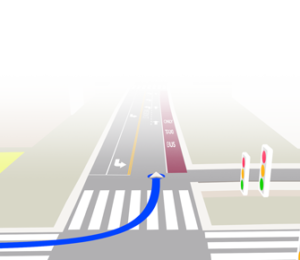
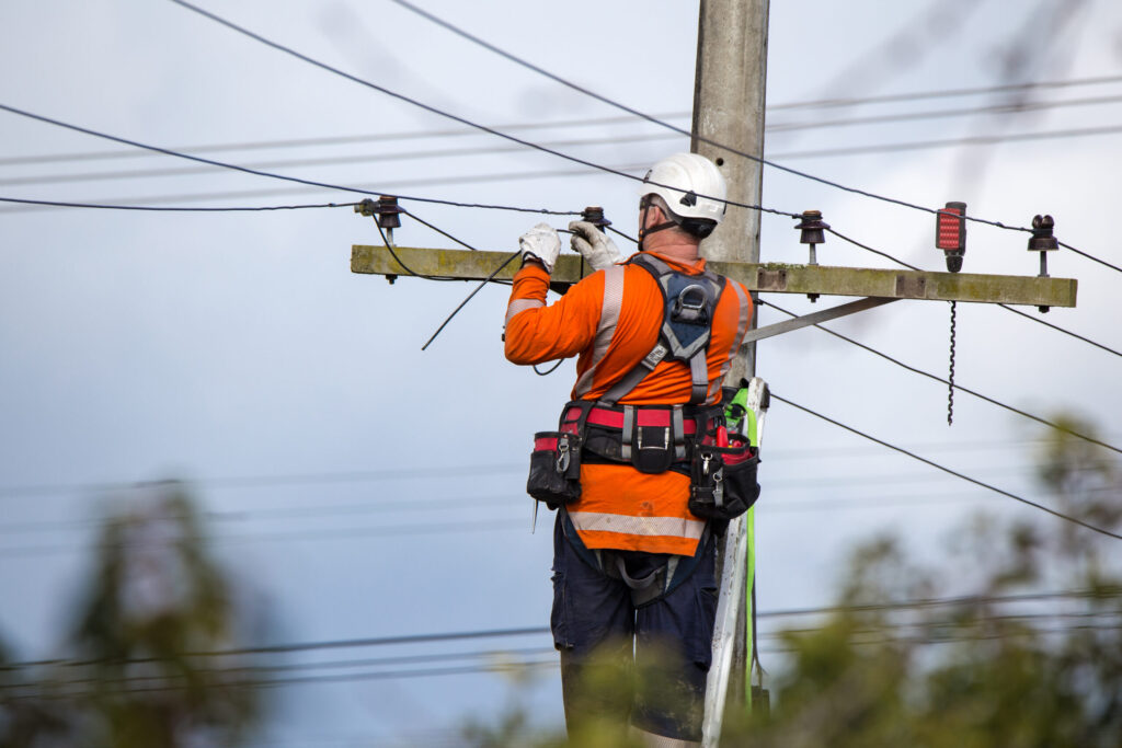
Rail: Managing Risk on the Tracks
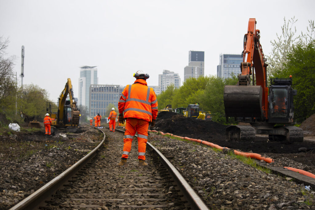
Rail maintenance and inspection teams often work along vast stretches of track, sometimes isolated from their colleagues. Their primary hazards include high-speed train traffic and high-voltage electrical systems.
The integration of high-precision location data allows for centimeter-level monitoring of personnel and equipment. This level of accuracy is vital for creating highly specific, dynamic geofenced zones around active hazards, such as welding operations, track maintenance vehicles, or approaching trains. By automatically tracking the location of workers relative to these real-time hazards, the system significantly reduces dependence on purely human-based lookouts and supervision. It ensures every movement is visible and safe, particularly in areas where sightlines may be obstructed or traffic is unpredictable. Crucially, the use of highly accurate alerting devices to automate safety protocols can dramatically boost efficiency; for instance, eliminating the typical 15-minute safety briefing required for a two-hour work block, enabling a 12% increase in time available for work.
Highways: Protection Amid Traffic Hazards
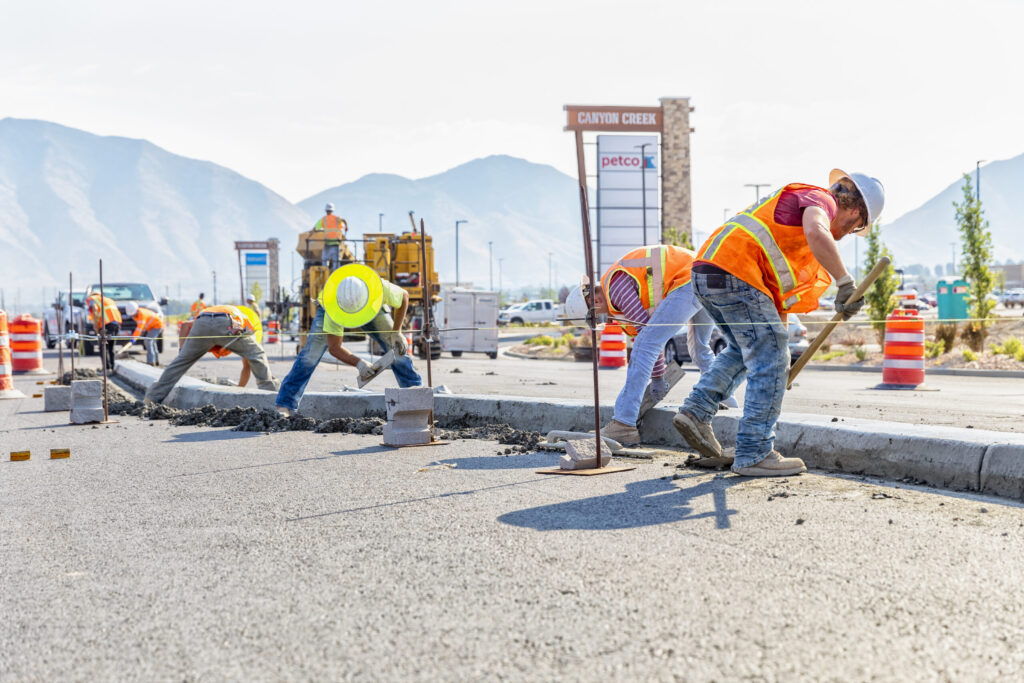
Highway maintenance crews operate in high-risk environments, working close to high-speed traffic, often in poor visibility or adverse weather.
High-accuracy location systems enable the precise definition of safe work zones, down to the centimeter-level. The system can send immediate, automated alerts to both workers (e.g., via a wearable device) and supervisors if personnel or vehicles enter a defined restricted zone, such as an active traffic lane or a dynamic equipment exclusion area. This lane-level precision, combined with real-time positional alerts, acts as a continuous safety net, ensuring crews remain protected and providing supervisors with continuous, high-fidelity oversight of the site layout and worker positioning.
Construction: Mitigating High-Risk Environments

Construction sites present a multitude of hazards, including moving heavy machinery, unstable terrain, and the use of power tools.
Utilizing a robust tracking device with resilient connectivity ensures workers remain locatable and connected, even when out of earshot or sight of colleagues. Beyond simple tracking, devices equipped with sophisticated sensors (e.g., accelerometers) can trigger immediate, automated alerts for events like man-down scenarios (a sudden fall) or no-movement alarms (inactivity over a defined period). Continuous, high-precision tracking ensures that emergency aid is directed to the exact location of the incident, critically reducing the time it takes to render assistance in often vast or complex construction sites.
Energy: Managing Risk in Remote and Hazardous Sites
Utility workers frequently operate in highly hazardous and often remote locations, including power plants, offshore platforms, and large-scale wind and solar farms.
The combination of resilient multi-connectivity (ensuring data transmission in remote areas) with precise GNSS corrections provides uninterrupted, highly reliable monitoring. This continuous positional data is crucial for regulatory compliance in high-hazard zones and is essential for enabling a rapid response to severe electrical, chemical, or environmental hazards. The increased accuracy aids in managing access and ensuring personnel are clear of zones where work on high-voltage lines or critical infrastructure is taking place, thereby enhancing both personal safety and operational security.
Partnership Focus: Swift Navigation's High-Precision GNSS Corrections, Lightbug's Resilient Tracking, and Quectel’s Advanced GNSS Modules – A Three-Pillar Solution
The demand for uncompromising safety standards has fostered collaborative solutions that merge the core competencies of precision technology, resilient tracking, and reliable hardware.
This key partnership unites Swift Navigation‘s global cloud-based GNSS correction service with Lightbug’s rugged, multi-modal IoT tracking devices, and is underpinned by Quectel’s high-performance GNSS modules.
The foundation of the combined solution is Swift Navigation’s Skylark™ Precise Positioning Service, a cloud-based GNSS correction service. This service is critical because it improves ordinary GNSS accuracy—which typically ranges from 3–10 meters—down to less than 2 cm with an instant fix for its highest-precision variant. For workers outdoors, this means every position update is exact, drift-free, and reliable, even in remote or obstructed areas.
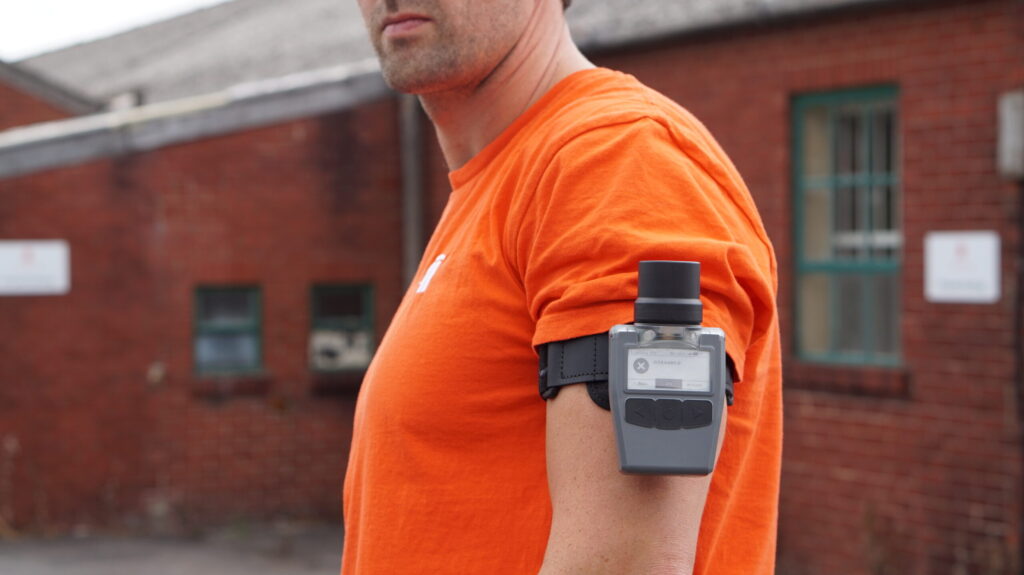
Complementing this, Lightbug provides its rugged, long-lasting personnel tracker, the RH2. This device is equipped with multi-network connectivity (e.g., GSM, NB-IoT, LTE-M) and advanced indoor positioning technologies (e.g., UWB, Wi-Fi, Beacons). The RH2 is built for continuous use, offering over 50 hours of continuous operation in a rugged, portable package. By receiving Swift’s high-accuracy corrections, the RH2 can achieve real-world performance of 1–10 cm accuracy in open sky and sub-30 cm accuracy in partially obstructed conditions, meeting stringent industry requirements like Network Rail’s 300 mm standard. Lightbug ensures continuous tracking when standard GNSS alone struggles.
The hardware engine enabling this level of precision and connectivity within the tracker is provided by Quectel. Lightbug’s RH2 ultra-high accuracy device specifically integrates the Quectel LC29H(EA) dual-band GNSS module. This module is essential for simultaneously tracking high performance L1/L5 satellite signals and leveraging Skylark Nx RTK corrections received over the cellular data network to achieve centimeter-level positioning accuracy.
Together, the three technologies form a cohesive ecosystem where each partner contributes its core strength: Swift Navigation delivers the precise, cloud-based GNSS corrections that make centimeter-level accuracy possible; Lightbug ensures resilient, continuous tracking across complex environments; and Quectel provides the advanced GNSS receiver hardware that anchors the system in reliable, real-world performance. It’s a model of how open collaboration outperforms closed systems—each partner focusing on what it does best to create a solution that is more accurate, more resilient, and more scalable than any single-vendor approach.
Real-World Impact: Raising the Standard for Worker Protection
For employers, the solution goes beyond compliance. It demonstrates a genuine duty of care, reduces liability exposure, enables better oversight of workforce deployment, and ultimately helps protect lives. For workers, it offers peace of mind because hazard risks are actively mitigated, making them not only feel safer but also allowing them to work efficiently and focus on their job with peace of mind. The system makes their job significantly easier by providing absolute location clarity, removing the stress of accidentally walking into a restricted or hazardous zone due to darkness, poor visibility, or simple oversight.
The future of worker safety is accurate, continuous, and reliable. With centimeter-level GNSS corrections and resilient multi-modal tracking, dangerous blind spots disappear, and safety becomes a constant. When employers prioritize worker safety, they not only protect their workforce – they also enhance their reputation as an employer of choice.
Contact our team today to learn more about our joint solution for worker safety.