


Helios Visions Uses Swift Navigation’s Network RTK Service to Power Drone-Based Environmental Cleanup
When a river cleanup project required precise drone mapping without room for base stations, Chicago-based Helios Visions relied on Swift Navigation’s Skylark™ Precise Positioning Service. Skylark’s cloud-based RTK delivered centimeter accuracy along miles of winding waterways, enabling fast, mobile operations directly from boats—without the setup delays of traditional RTK systems.
Arrive Modernizes Urban Parking Management Using Skylark Precise Positioning Service

By using Swift Navigation’s Skylark Precise Positioning Service, Arrive Group have fundamentally redefined how municipalities acquire, understand, and manage their on-street parking infrastructure.
TecSolutions Consultants Simplifies the Purchase and Setup of Utility Locating Solutions With GNSS Corrections From Swift Navigation
Utility locating crews need simple tools to achieve high accuracy location. TecSolutions is delivering that simplicity
with a complete solution that leverages Swift’s Skylark Precise Positioning Service to enhance precision right out of
the box.
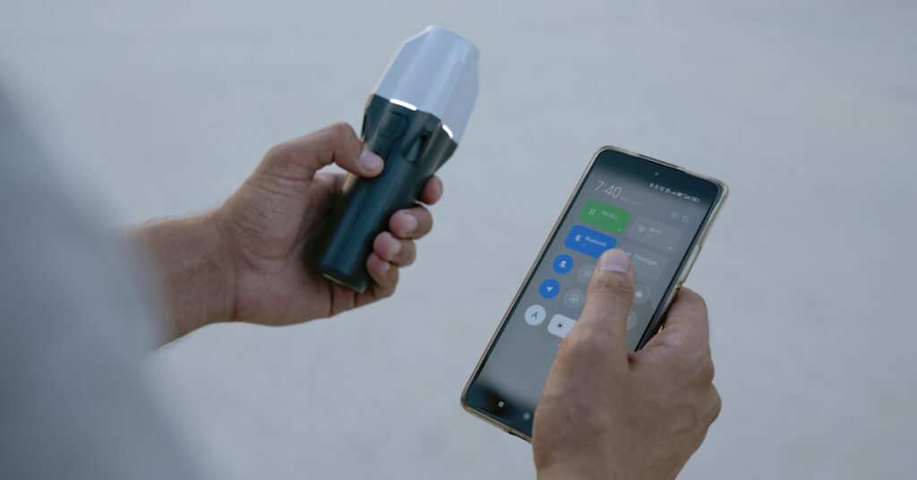
How to set up the Bad Elf Flex Mini with RTK Corrections
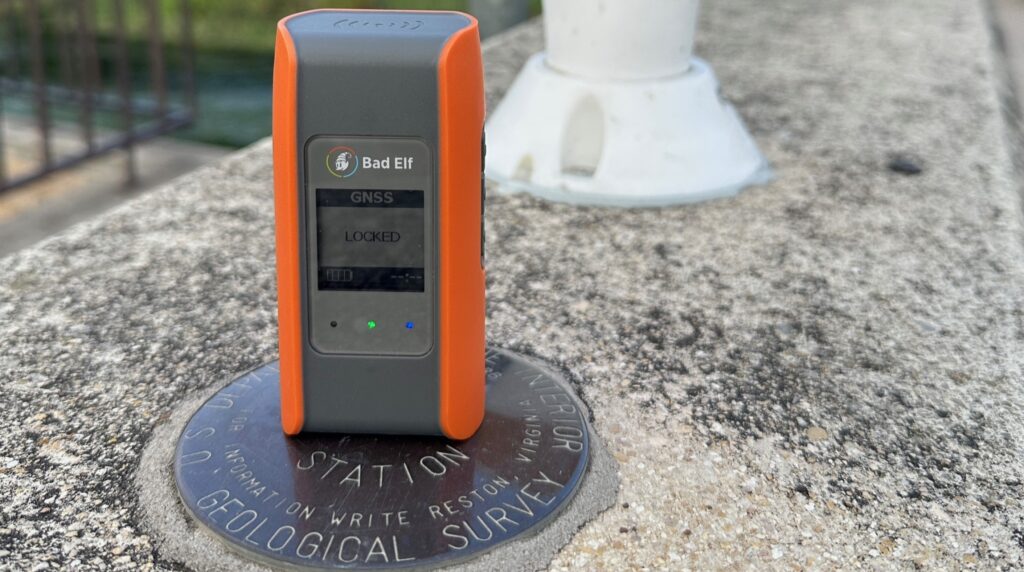
Inaccurate GPS data can lead to costly errors in utility surveying, construction, and asset monitoring. Fortunately,
ith the Bad Elf Flex Mini, you can turn your smartphone, tablet, or laptop into a high-precision tool capable of delivering centimeter-level accuracy using RTK corrections.
How to set up the Emlid Reach RX with RTK Corrections
Emlid’s Reach RX is an easy-to-use GNSS receiver for location data collection in the field. Designed to meet the
needs of both experienced professionals and non-surveyors who require highly accurate results, this groundbreaking device is one of the simplest devices for geographic data collection.
Deutsche Telekom Lays Fiber Quickly and Safely With Skylark GNSS Corrections

Deutsche Telekom is using Skylark to increase efficiency and improve safety as they roll out fiber optic cable
throughout Germany. With Skylark, DT can precisely map trenches and avoid buried power lines without the need
for licensed surveyors.
3 Signs Your GIS Mapping Process is Broken (And How to Fix It)

Geographic Information Systems (GIS) have become indispensable tools in various fields, transforming the way we
analyze, interpret, and visualize spatial data. From urban planning and environmental management to disaster
response and precision agriculture, GIS applications have permeated many aspects of our lives. As applications for
GIS grow, the demand for data grows along with it. And when the use cases require high precision location, scaling
data capture processes can become a challenge.