What is Single Baseline RTK?
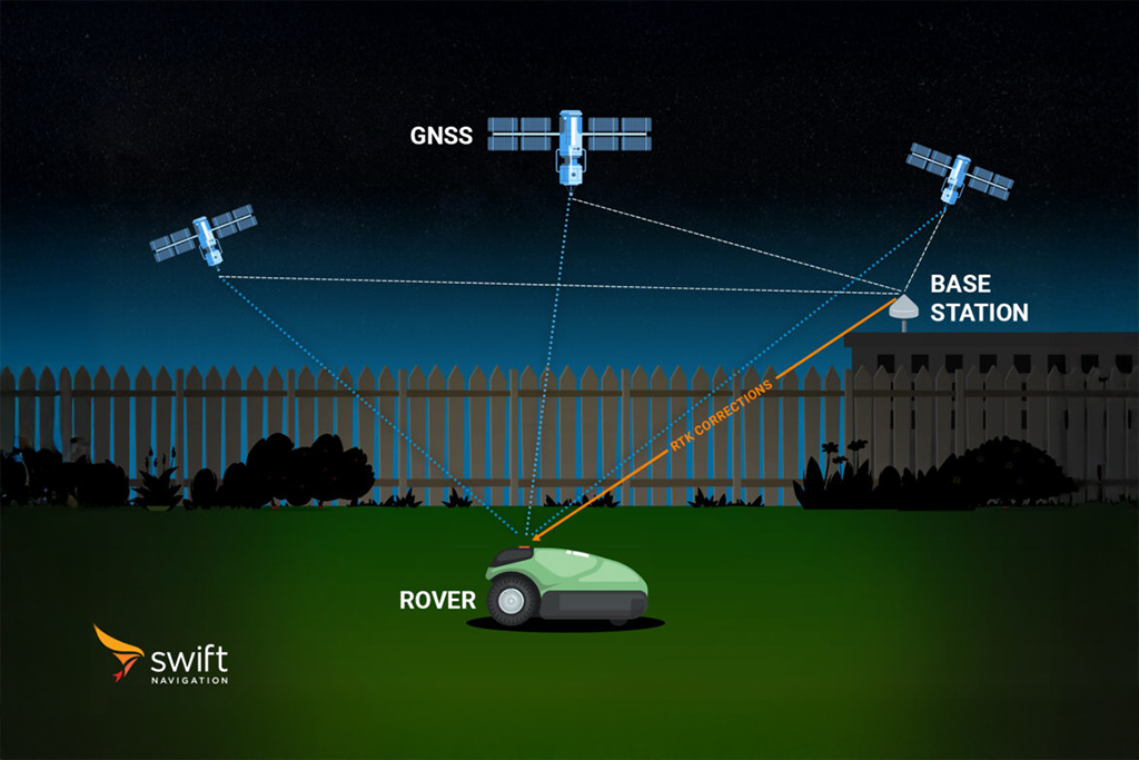
Single baseline RTK refers to an RTK configuration where a rover receives correction data from a single physical base station located at a known position. The “baseline” is the distance between the base station and the rover. In this setup, the base station calculates GNSS corrections based on its known location and transmits them directly to the rover via radio or network link. The rover uses these corrections to resolve carrier phase ambiguities and achieve high-precision positioning – typically at the centimeter level when conditions are optimal.
Single baseline RTK is straightforward to deploy and is commonly used in surveying, construction, and precision agriculture. However, its accuracy degrades as the baseline length increases (typically beyond 10–30 km), due to spatially varying errors like atmospheric delays that cannot be fully corrected by a single reference station. For larger areas or more robust performance, Network RTK solutions such as Skylark Nx RTK, which use multiple reference stations, are preferred. Single baseline RTK remains a cost-effective and reliable solution for localized high-precision applications.
To learn more about RTK and the other GNSS correction types, such as SBAS and PPP-RTK, read our blog What are the Different GNSS Correction Methods?
Related Content
GNSS Basics

Devon Sharp

Marwan Ramadan

Marwan Ramadan

Devon Sharp

Devon Sharp

Marwan Ramadan

Devon Sharp

Marwan Ramadan
GIS

Devon Sharp

Devon Sharp
ROBOTICS

Marwan Ramadan


