What is a Virtual Reference Station (VRS)?

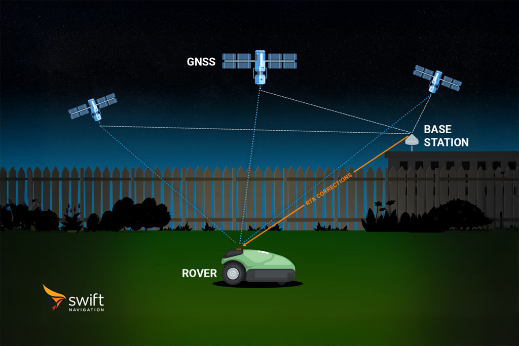
A Virtual Reference Station (VRS) is a key component in network-based Real-Time Kinematic (RTK) positioning solutions. In a VRS system, a network of fixed GNSS reference stations is used to model and correct for errors in satellite positioning signals over a wide area. When a user’s GNSS receiver (the “rover”) requests corrections, the network generates a set of synthetic correction data as if there were a physical reference station located near the rover’s current position. This “virtual” station provides highly localized corrections, improving positioning accuracy and reliability. The rover cannot distinguish between corrections from a physical base station and those from a VRS. 


How Does a Virtual Reference Station Work?

The virtual reference station generation process follows three steps:

  1. Rover position request: When the rover connects to the NTRIP caster, it sends its approximate position (from standard GNSS) as an NMEA GGA sentence.
  2. VRS synthesis: The Network RTK server locates the rover on its model, built from surrounding CORS stations. It synthesises the GNSS observations that a physical reference station at (or near) the rover’s location would record — applying the correct ionospheric delay, tropospheric delay, satellite geometry, and phase biases for that specific point.
  3. Correction delivery: The server streams the synthesised reference observations to the rover in standard RTCM 3.x format. The rover’s RTK engine sees these corrections as if they came from a real base station a few kilometres away, resolves ambiguities nearly instantly, and achieves a fixed solution.


Benefits of VRS

  • Instant fix: Because the effective baseline between the VRS and rover is essentially zero, integer ambiguities resolve in seconds or less.
  • Receiver compatibility: Any standards-compliant RTK receiver can use VRS corrections with no modifications — a major adoption advantage.
  • No base station required: Users access VRS service via subscription, eliminating the cost and complexity of owning and maintaining a base station.

VRS and Skylark Nx RTK

Skylark Nx RTK is built on VRS technology, enhanced by Swift Navigation's proprietary atmospheric model. The atmospheric model uses machine learning to interpolate ionospheric and tropospheric delays between reference stations more accurately than traditional spatial interpolation methods — enabling broader coverage and faster, more reliable ambiguity resolution even at the edges of the network.

View the global coverage map or start a free trial →

Frequently Asked Questions

Yes. The VRS approach requires the rover to send its approximate position to the server (via NMEA GGA), and the server to stream VRS corrections back to the rover. This requires a bidirectional data connection, typically cellular (4G/LTE). One-way broadcast approaches (e.g., SBAS) do not have this requirement but are less accurate.

Each rover requires its own unique VRS computation (because the corrections are tailored to its specific location). However, modern cloud-based Network RTK servers like Skylark's AWS infrastructure can compute and serve VRS corrections for millions of simultaneous rovers by parallelising the computation. There is no practical limit for users of cloud-native services.

As the rover moves, it periodically sends updated GGA position strings to the server. The server updates the VRS location accordingly, recomputing corrections for the rover's new position. The update frequency depends on the correction update rate (typically 1–5 Hz) and the rover's speed.

Related Glossary Terms

Related Content

GNSS Basics